In a life threatening emergency dial Triple Zero (000)
Storm and Flood Assistance
These visuals may be confronting but are not intended to create fear or panic. Their purpose is to motivate our community to respond to warnings, alerts and calls to action.
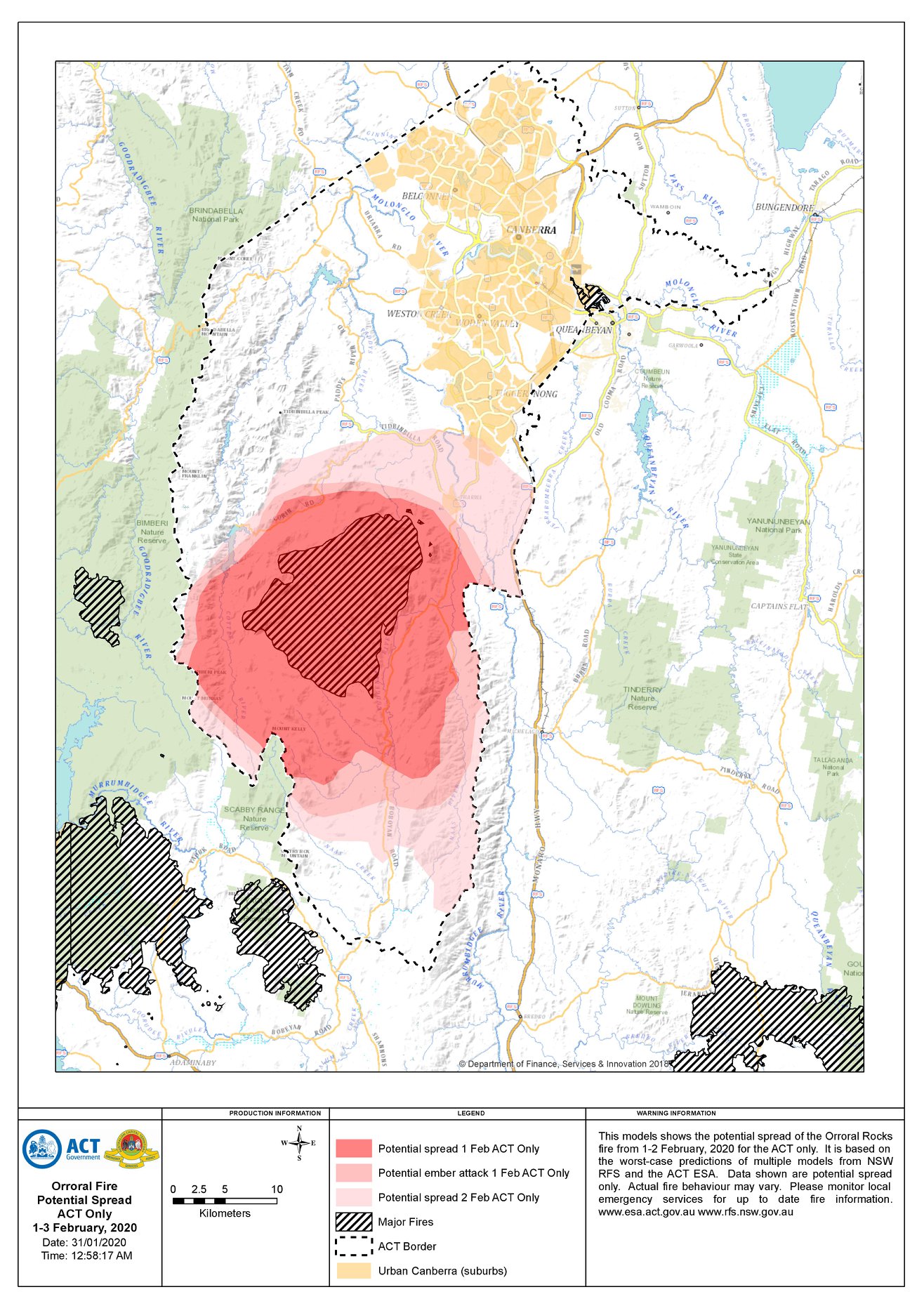
The left image shows the potential spread of the Orroral Valley Fire from Friday 31 January - Sunday 2 February 2020 for the ACT only.
This image is based on worst-case predictions from multiple fire behaviour scenarios for the ACT and encompasses three days of worst-case modelled bush fire activity based on temperature range, wind variations, atmospheric pressure, relative humidity, terrain, and fuel availability.
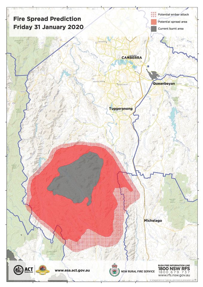
The right image has been developed by the NSW Rural Fire Service (NSWRFS).
These images may appear to differ. The reason is:
• the ACT model shows a larger potential burn area and locations at risk of ember attack if current areas of spotting are not contained.
• the NSW image depicts a 24-hour model while the ACT image depicts a 72-hour model.
• the ACT image also reflects the impact of more extreme localised weather conditions experienced across the Territory in recent weeks.
• you will notice that the core burn area for both models is consistent.
These models are predictions only and are not a reflection of current fire activity. They are an indication of how the Orroral Valley fire may behave in the coming days.
Thank you Canberra. In closing, be alert not alarmed.
NOTE: Data shown are potential spread only. Actual fire behaviour may vary. Please monitor local emergency services for up to date fire information: www.esa.act.gov.au and www.rfs.nsw.gov.au